Barton Hill litter pick
Saturday 18th March was a fine warm day and your ‘umble scribe had received an invitation from a friend Eric in the neighbouring district of Barton Hill to participate in the regular monthly community litter pick, which I’d committed to doing as I’d forgotten about the previous event due to strong drink having been taken the night before.
At 10 am three of us – Eric, Shona and your correspondent – all equipped with gloves, litter pickers and bags all set off into the Urban Park, mainly to concentrate on clearing its fences, hedges and shrubbery of wind-blown litter – mostly plastic carrier bags and sweet and snack wrappers. – although we did encounter recyclable materials such as bottles and cans which were duly placed in separate bags. One worrying development was the large nitrous oxide catering cylinders (note to users: I have no personal beef with you wanting to have a pharmaceutically-induced giggle, but please dispose of the waste properly 😀 ).
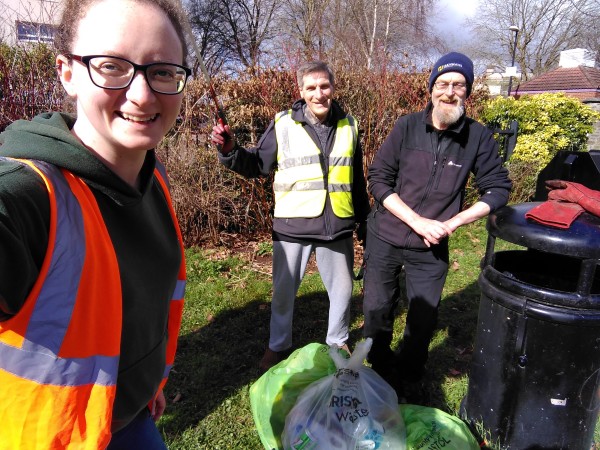
Anyway at the end of an hour that went very quickly, encouraged by smiles and kind words from passers-by, the flowers and blossom that were blooming, we’d collected 5 bags of grot for collection by Bristol Waste and retreated to the Wellspring Settlement for a cuppa before dispersing for the rest of the day.
A final footnote. Whilst in the Urban Park it was good to note that repairs to the poor quality surface around the play equipment area were finally being carried out after at least 3 years’ lobbying by concerned local residents.
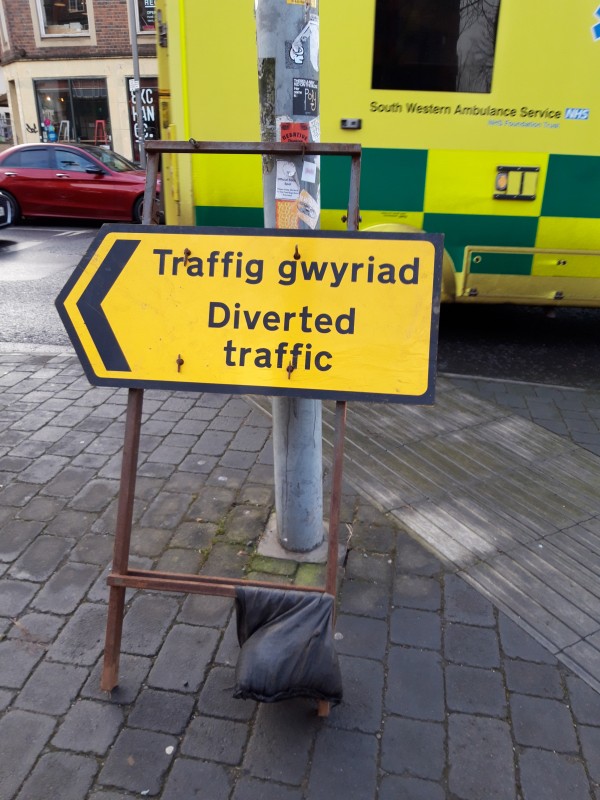
![Headline reads M4 disruption for over 5 hours due to repair potholes [sic]](http://xislblogs.xtreamlab.net/slwoods/wp-content/uploads//sites/23/2023/03/post_severn_bridge.png)


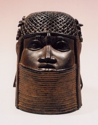 In 1897 British troops attacked, burned down and looted the palace of the Oba (king) of